


Kiyoko-san, our wonderful host in Iriomote-so


Kiyoko-san, originally from Sado Island, hosted us for five nights. Full of energy and willingness to help her guests, she is like sunshine on Iriomote!
We enjoyed her family-style meals, ate countless small but richly tasted bananas directly harvested from the garden. She felt sorry for her guests who were stuck on the rainy and unusually cold day and fed us with her tasty home-made Okinawa doughnuts.
Thanks to her, our memory for Iriomote is special and heart-warming.
Firefly spectacle

Our friendly B&B owner Kiyoko-san kindly offered to take us to firefly watching. We got on her mini-van with Japanese, American and Dutch guests and drove to a rice paddy area. It was the last week of the firefly season, Kiyoko-san told us. When we arrived, some cars already parked here and there.
We walked a while on a forest road and as our eyes got used to the darkness, we started to see thousands of firefly flying in the dense foliage. The higher up we got, the more fireflies were there. It felt like we were floating in the darkness surrounded by thousands of flying lights.
What a captivating spectacle it was!
Kayaking to Mariyudō-no-taki waterfalls
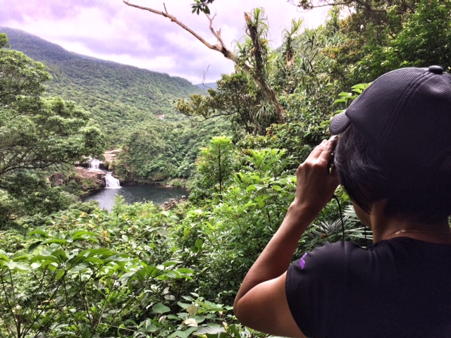
Iriomote’s number-one attraction is a boat trip up the Urauchi-gawa (浦内川), a winding brown river reminiscent of a tiny stretch of the Amazon.
We rented a kayak from the mouth of the river, Urauchi-gawa Kankō (浦内川観光 ) and paddled up 6 km braving against the wind. Then we joined the tourists who came by the boat to continue another 2 km on foot all the way in the jungle to the waterfall.
For us, the main attraction of this trip is the paddling along the mangrove rivershore. Iriomote island is the only place in subtropical Japan where one can do that. The one hour of rain all the way back and the winds were not a problem at all. We got all wet but the warm temperature balanced it out.
Except occasional boats which carry sightseeing tourists (who always waved at us), we were floating on the water all alone sandwiched by the dense, humid mangrove forests and forgot that we are in Japan.


Ida-no-hama, a day at the Beach

Bus, boat and a walk to a very pretty, remote and quiet beach, Ida-no-Hama.
The boat trip leads to a village called Funauki (船浮). This village, only accessible by boat, has no more than 45 inhabitants, two local restaurants, a huge elementary school building and two vending machines. No street leading to the beach.


Eiheiji Zen Temple – we found Zen in eating
Great picture and slogan from the Zen Temple „Eiheiji“ campaign

Ramen: Focus on Taste
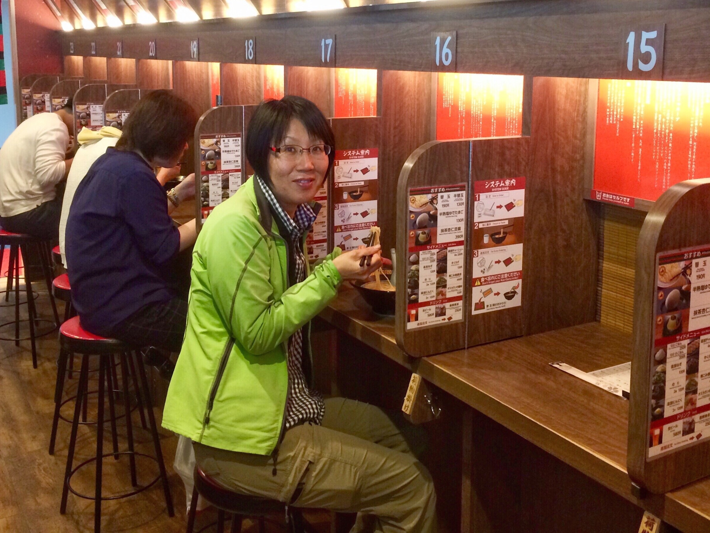
We had a 30 minutes layover at the Fukuoka airport to take the connecting flight to Ishigaki – more than enough for a quick slurp of Yasuko’s favorite ramen style, tonkotsu. And as we are at an airport, the usual food service efficiency needs, bien évidemment , to be cranked up a notch or two.
It took precisely 4 minutes from “Yes I do” (want ramen) to the first slurp.
Just respectfully …
- chose your version of ramen and pay for the voucher at the vending machine
- move to your own private ramen booth
- shout “sumimasen” (excuse me) to get the waiters attention
- hand over the voucher with some extra instructions (for those in the know)
- wait 2.5 minutes until that steaming bowl flies to you
And now, ladies and gentlemen, close your eyes, lower your heartbeat (oooohm), ignore any funny noises around you, overclock your taste buds and follow the second instruction on the ramen manual sticker on your left which reads: “Focus on Taste” 🇯🇵🍜


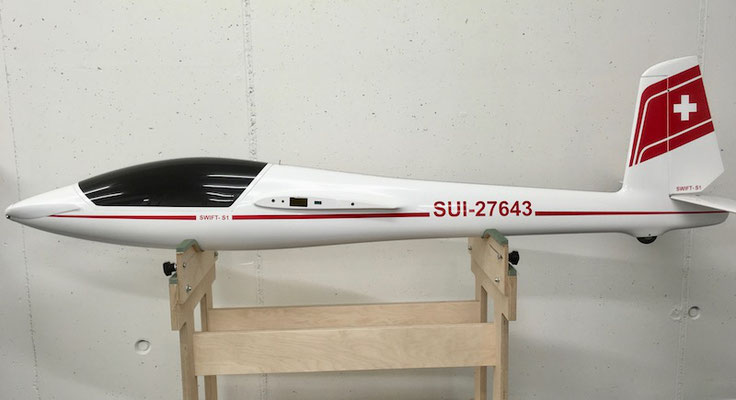
Xmodels Swift-S1 FES, 3.20m
Allgemeines
Modelltyp: Segelkunstflug
Masstab: 1:4, Scalemodell
Ausführung: Voll-Gfk/Cfk, HS-Version
Fabrikat: xmodels.it
Bezug: leomotion.com
Read More
Via Alpina: Hohtürli to Kandersteg
Via Alpina, Section 13 – Part 2
Griesalp (1’408 m) – Bundalp (1’840 m) – Hohtürli (2’774 m) – Blümlisalphütte (2’834 m) – Oeschinensee (1’593 m) – Kandersteg (1’176 m)
16km, 1’550 m up and 1’750 m down
The path from Blüemlisalp to Kandersteg via Öschinensee is, in my opinion, the most scenic and dramatic part of the entire Via Alpina route… and strenuous.

After a day of hard work hiking up, Caroline and I were happy to arrive at the highest point of the Via Alpina, the famous Blümlisalphütte (2834m), in the middle of an impressive alpine setting.


From the hut, we had a sweeping view of the surrounding area, the snow-capped Blüemlisalp mountain chain just behind it and even the Lake Thun far in the north. Some mountains have interesting names, such as Wildi Frau and Wyssi Frau. We took many photos, enjoyed superb views, and had leisurely lunch on the pleasant hut terrace with other hikers who all looked happy. But we also had to mentally prepare for the long descent to the valley of Kandersteg – 1’700 m downhill, that is.


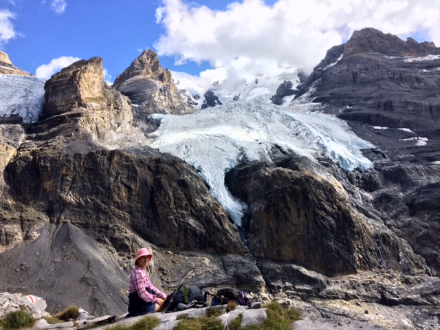
The descent was terribly steep and slippery. But the dramatic Blüemlisalp Glacier and nearby mountains kept our eyes hooked.


Dramatic glacier views!


Down, down, down….


Soon the shining, turquoise Öschinensee took our breath away!


After arriving at the lake, we met and had a friendly chat with one of our American hikers we shared a table with at the Rotstockhütte. Forgetting about time, we suddenly realized that the last gondola down to the valley was scheduled in 10 minutes! We ran frantically towards the station but soon realized that we wouldn’t make it. So instead of putting our feet up in the gondola, those very feet had to carry us downhill another 500 m of altitude loss. Gosh, we were all ready to call it a day and now we had to convince our legs to continue …
Our unlucky situation made me laugh but somehow still put me in high spirits. I’m not completely sure if my hiking friend, Caroline, felt in the same way.
On the way down a car passed by and was stopped by Caroline. He pointed out the way to the train station, but finally felt sorry for us and gave us a ride to the train station. We were very, very grateful!


After saying goodbye to Caroline who was heading back for Zurich by train, I walked to my hotel in Kandersteg and happily put my feet up, reliving today’s stupendous sceneries in my head. It was an exhausting but phenomenal day!
Tomorrow Philippe will arrive in Kandersteg and be my hiking companion for the next 2 days. I am looking forward to it!
Griesalp to Hohtürli

Via Alpina, Section 13 – Part 1
Griesalp (1408m) – Bundalp (1840m) – Hohtürli (2774m) – Blümlisalphütte (2840m) – Oeschinensee (1593m) – Kandersteg (1176m)
16km, 1550m up and 1750m down
Today is one of the hardest hikes on the Via Alpina route, almost 1,400m up to the highest pass of this trail (2,774m). The Via Alpina has a total of 14 passes.
Unlike yesterday, today the sun is out and the blue sky smiles at us.
After a hearty breakfast, we’re ready for the big day!
Leaving behind our beautiful, cozy hotel, we went down to the village center. Not that we wanted to go down but the route does not give us a choice. The center is nothing more than a bus stop and a couple of hotels. Like us a bit earlier, many hikers were getting ready for the next stretch.
Crossing the river, the climb started on the other side of the valley. The first stretch was through the woods. Several hikers were on the trail as well. A bit later, we walked through pasture land and passed a couple of farmhouses to finally reach a restaurant at Bundalp (1,840m). It looked enticing, but too early to have a break, we skipped it and continued.

At this time I told Caroline that we had gone up roughly one third of today’s ascent, only another 1,000 m up to go. Not sure whether it was encouraging or discouraging…

A little bit later, the imposing Blümlisalp Massif and the Blümlisalphütte appeared on the hoirzon, today’s highest point as well as our lunch destination. The hut seemed to be sitting on the boulder, majestic, far and away.

It was very sunny and it seemed a popular route, with a lot of hikers on the trail.

The steep slope was criss-crossed with many paths.

We looked up to the hut on the boulder under the blue sky often. What a fantastic sight! The more altitude we gained, the more of yesterday’s path we could see on the opposite side of the valley, even the Sefinenfurgge pass, yesterday’s highest point .
I always love seeing the travelled route and pass of the day before. It helps me to understand the exact geography of the area. It is like creating your own 3D map in your head.
The rugged Gespaltenhorn (3426m) and Gespaltenhornhütte at the foot were also visible. The dutch couple we met the day before went into this direction. That route seemed not funny….

After we managed some narrow path on the ridge, the famous steps to Hohtürli appeared. The stairs seemed to wind up endlessly.

One step after the other. Luckily no one was coming down and we did not need to cross other hikers on those narrow steps.


The last stretch on the stairs looked vertical! The sweat was streaming down on my face while I was concentrating on the steps ahead of me, not looking at the steep slope going down several hundreds meters.

After some hundreds of steps, I reached at the top of staircase and Caroline came up just after me and smiled, when seeing the hut in front of us. Done.

Finally at the Hohtürli (= the high small door), 2774m. We made it!


